The history of Cheney Row Park and the Folly Lane Triangle stretches back at least 1,000 years, which we have pieced together here as a story in rough chronological order. We also offer a glimpse into the future.
- The Early Years of Hecham
- Medieval Pilgrims of Amberland
- A Tale of Two Manors
- Elizabethan Dispute at The Folly
- Rural Georgian Estates
- Brickfields and Brick Factories
- The Lea and Reservoir Chain
- Land of Victorian Righteousness
- Cheney Row and Durban Road
- A406 Walthamstow Avenue
- Sports Grounds and Allotments
- World War II Anti-Aircraft Guns
- The Landfill Mystery
- A Valley of Electric Fields
- Lee Valley Regional Park
- Muslim Cemetery
- Cheney Row Park
- Banbury Park Estate
- Future Vision for Banbury
The Early Years of Hecham
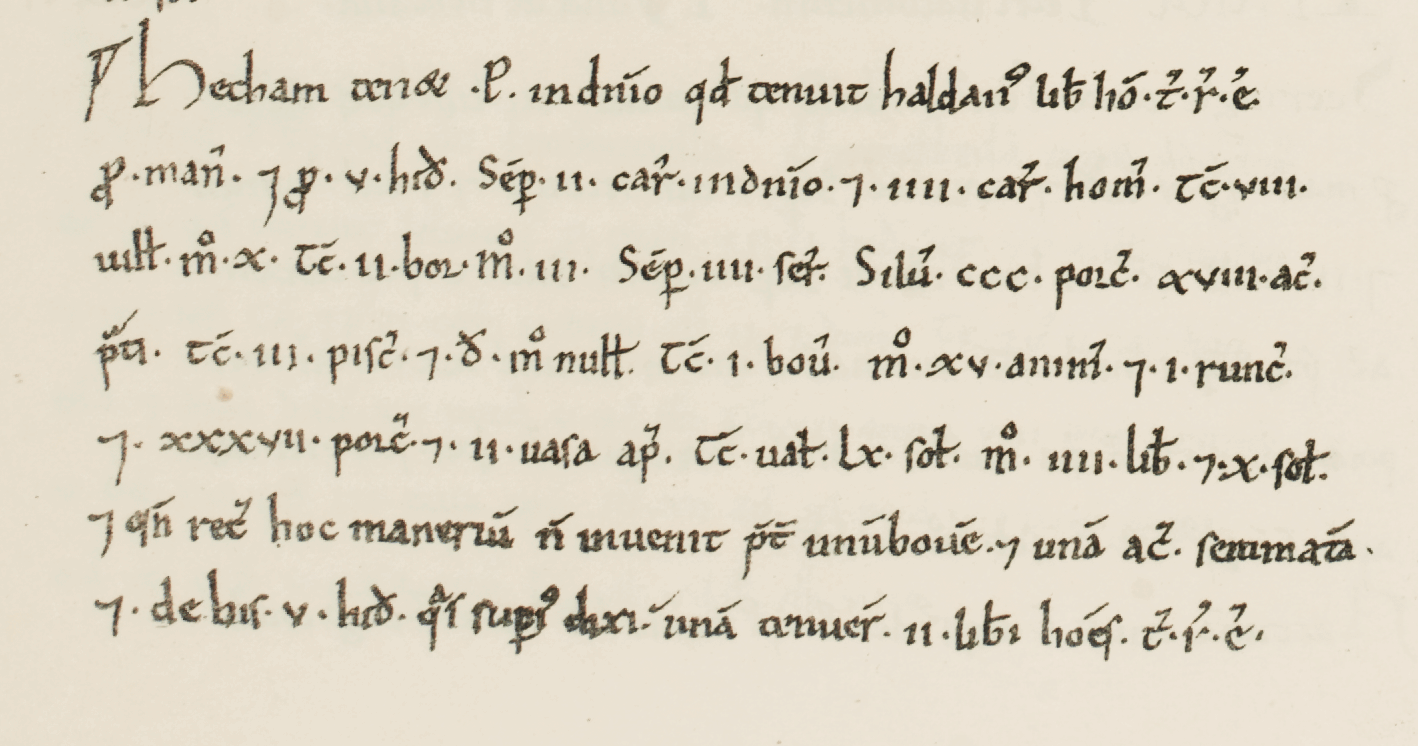
1086: Higham [Hill] was a settlement in the Domesday Book, in the hundred of Becontree and the county of Essex, with a population of 17 households. The entry says that Peter de Valence (Peter de Valognes) held Hecham as his own estate – land that a free man named Haldane held in the reign of King Edward (before the Norman conquest).
The Hech– of Middle English ‘Hecham’ is from Old English hēah. ‘Higham‘ derives from hēah-hām meaning “high homestead”, or from hēah-hamm meaning “high river enclosure”. ‘Walthamstow‘ derives from Old English Wilcumestow, meaning “welcome place” (wilcuma “welcome, a welcome guest” + stow “holy place, place of assembly”).
Medieval Pilgrims of Amberland
1200’s: According to local Walthamstow historian Bill Bayliss, in the middle ages Amberland Lane (today’s Folly Lane) was part of a dry land route between Stratford Langthorne Abbey and Waltham Abbey via Cooks Ferry (where the A406 crosses the Lee today) and Sewardstone. Waltham Abbey was a significant pilgrimage site from the 11th century due to the legend of the Holy Cross.
At that time much of the area around the River Lea was impassable marsh land. During the 13th century, causeways and flood management were built of part of royal and ecclesiastical interest in making it passable.
A plausible route would have been from Stratford, north along the west bank to Leyton, crossing the Lea at a managed point, up to Walthamstow village (on a high ridge), and north through Chingford to Waltham. The direct route would be along Chingford Rd / Chingford Mount Rd, and VCH describes this as the chief road from Waltham Holy Cross to Stratford. However that meant climbing a steep hill at Chingford Mount.
Maybe a route existed from Folly Lane at its Chingford end that skirted the hill on lower ground that was passable through marshland? Unfortunately there is little surviving evidence beyond Bill Bayliss’ assertion. There is a modern-day revival of the London to Walsingham Camino – its route through Walthamstow is along the Lea towpath, making Folly Lane equidistant between the old and the new.
A Tale of Two Manors
A manor was land held by a lord under feudal tenure, comprising the lord’s demesne for his own use, tenant holdings, rights of jurisdiction, and associated rents. A manor-house was the residential building on that estate where the lord lived.
1305: Higham manor, and a house later known as Waterhall or Moons, had passed to Alexander de Balliol of the Royal House of Scotland. He sold it to John de Benstede, who also purchased a separate estate spread across Higham, Walthamstow, Chingford and Sewardstone that become known as Benstedes. In 1429, Sir Edward de Benstede consolidated the two estates as a single manor called Higham Bensted.
1310: Alexander de Balliol died holding land between Billet Road and Chingford, with fields on either side of Folly Lane and Chingford Road. This was sold to Adam of Salisbury in 1323 and it become the manor of Salisbury Hall, sibling to Higham Benstead. The boundaries between the two were only properly defined in the 19th century; their fields intermixed and tenants held leases in both, which lead to disputes.
1442: Salisbury Hall manor was owned by Sir William Tyrwhitt who built Higham chapel dedicated to St Edward the Confessor. This is the origin of the place-name Chapel End. It was described in 1519 as a free chapel and said to be in a ruinous state by 1650.
1499: The first mention (in court rolls) of the manor-house Salisbury Hall. It stood south of the Ching on the west side of Chingford Road – the site of a present-day car showroom opposite Walthamstow Stadium. It was re-built on the same site in the late 16th century.
1503: Higham Benstead was purchased by Sir John Heron, Treasurer of the Chamber under Henry VII and Henry VIII. It descended to his son Giles Heron, Member of Parliament for Thetford and one of the jurors who found against Anne Boleyn. Giles was executed for treason in 1540 and the manor passed to Henry VIII.
1566: Higham Benstead is sold to Thomas Rowe and it remained in the family for nearly two hundred years. In 1580, his son William Rowe married Anne Cheney; their son Cheney (or Cheyney) Rowe is likely whom the road Cheney Row is named after. William rebuilt the house called Higham Hill or Higham Hall that stood on the north side of the old junction of Billet Rd and Blackhorse La (now Sutton Rd).
1564: Salisbury Hall, which had been owned by the Crown since 1541, is leased to Roger Ascham who had been Elizabeth I’s tutor in Greek and Latin. The street Ascham End and the Roger Ascham Primary School are named after him.
1764: Anthony Bacon purchased Higham Benstead and built a new manor-house at Higham Bushes on the Woodford boundary. At first it was called Higham Hill, but later Higham House or just Highams. Edward Warner bought the manor in 1849. It descended to Sir Courtenay Warner in 1875, who progressively sold and developed the land, and built the Warner Estate. Highams remained the manor-house until 1919 when it became Woodford County High School for Girls.
1768: The original Higham Hall had been converted into two dwellings. It was called Essex Hall from the early 19th century and it became a school. In the 1920’s it was acquired by the council and demolished in 1934 when the Billet / Blackhorse junction was re-aligned and the housing up to Banbury reservoir were built. The present building on that site (313 Billet Road) dates from 1970.
1768: Salisbury Hall manor-house was described as old and mean; in 1817 as a commodious farm-house; and in 1904 as a comfortable residence when the estate was broken up. The last lord in residence, Edmund Ward Oliver, died in 1917. The manor-house was damaged during World War II and demolished in 1952.
Elizabethan Dispute at The Folly
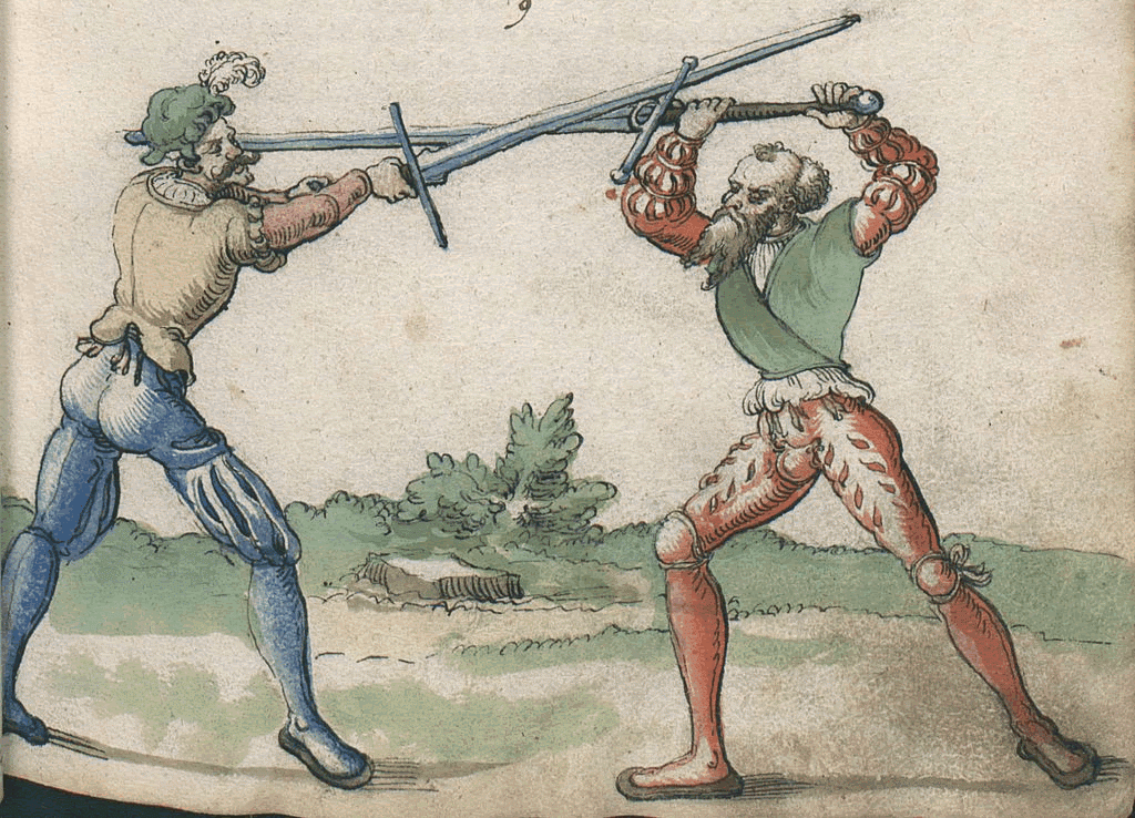
1587-91: The tenants of Higham Bensted claimed customary rights of after-pasture in Great Broadmead, west of Amberland Lane, which lay in the manors of both Higham Bensted and Salisbury Hall. Thomas Rampston of Salisbury Hall tried to close the Amberland gate against William Rowe of Higham Bensted and his tenants, denying them passage either to bring out hay or drive their cattle in to after-pasture.
This lead to violent disputes between the two manors, from which Salisbury seems to have prevailed. The gated section of Amberland then became known as Folly Lane. “Folly” perhaps in the sense of “foolish” – a contested, troublesome and legally fraught piece of ground that nobody could definitively claim, and which lead to years of conflict.
Mid-Victorian maps show it as Folly Lane except for the perpendicular section that joins Billet Road which was called Amble Lane. The exact location the gate is lost to time, however the path along the north edge of Cheney Row Park crossed open common meadow to reach Salisbury Hall, a right of way that probably existed since the 1300’s. Its junction with Folly Lane would have been at the corner of pasture land (Great Broadmead?) up to the River Lea, which is now beneath Banbury reservoir.
So, a likely location of Amberland Gate was by the bottom of the steps at the north west corner of Cheney Row Park.
Rural Georgian Estates
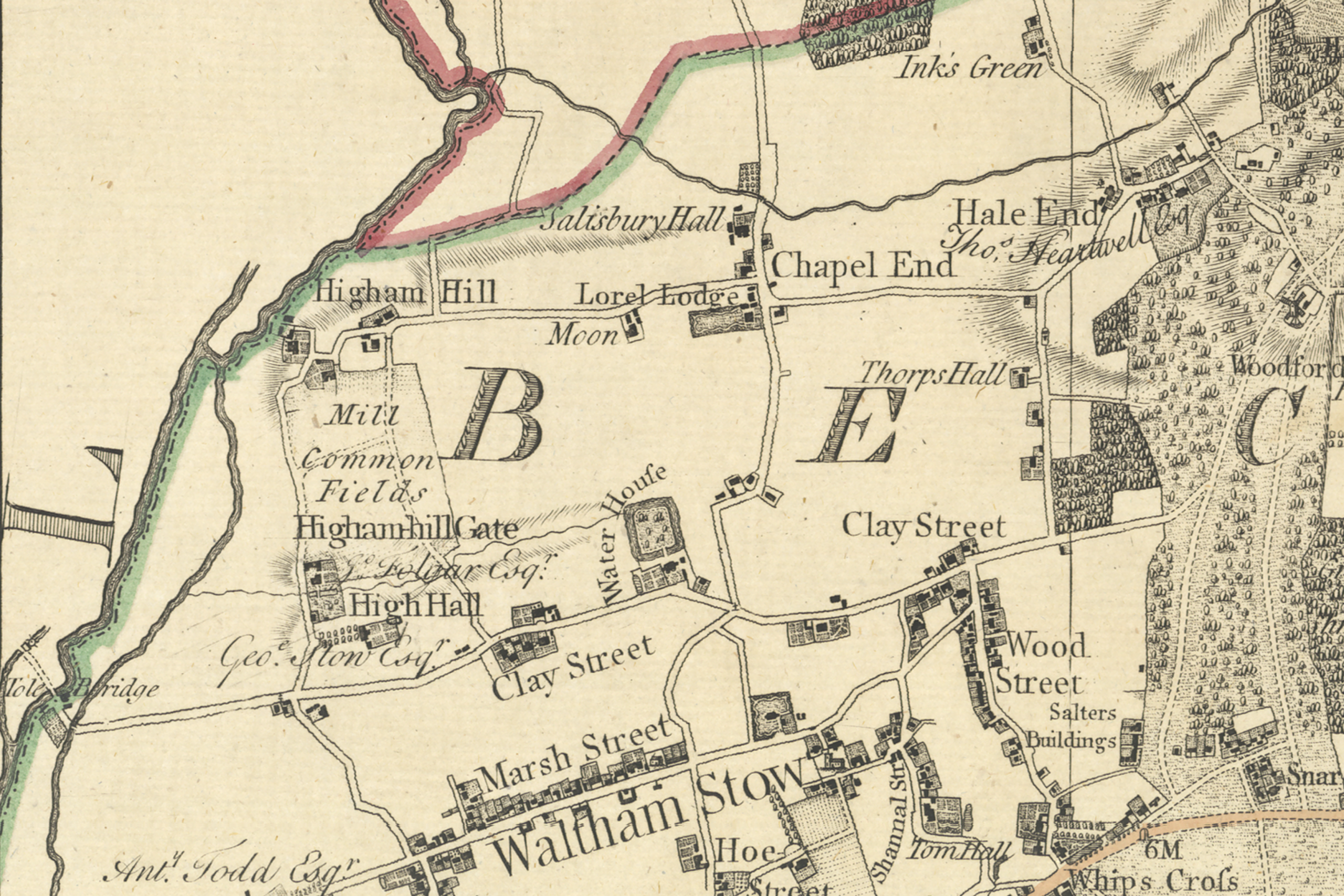
1777: Chapman and Andre’s first map of the entire of Essex shows Higham Hill and its surroundings were largely rural farmland with a scattering of buildings. Blackhorse Rd, Billet Rd, Higham Hill Rd, Chingford Rd, and Forest Rd (then called Clay Street) were the only roads along with Folly Lane, which ran north to Chingford Green along the route of today’s Hall Lane A1009.
Higham Hill manor-house and Moon’s are along Billet Rd. The footpath along the north of Cheney Row Park is visible which connected Folly Lane to Salisbury Hall on Chingford Rd (see above). The map also shows Water House with its moated island in what became Lloyd Park. Today, Water House is the William Morris Gallery.
Brickfields and Brick Factories
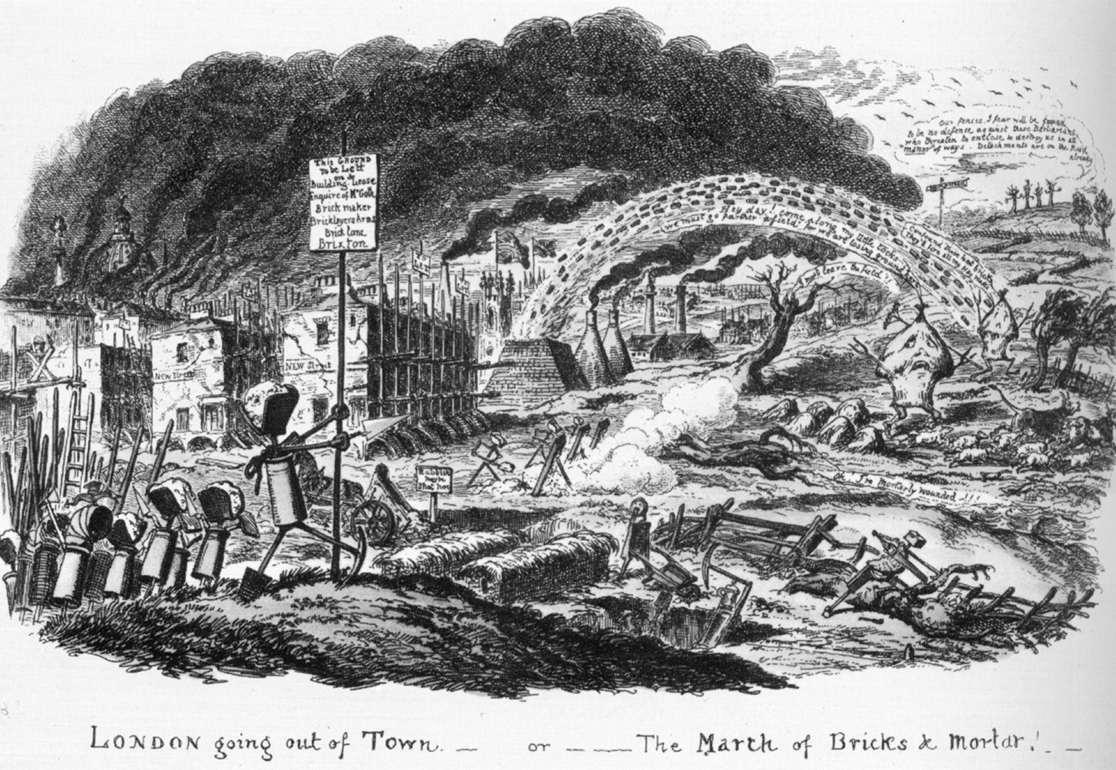
A History of the County of Essex: Volume 6 (1973), says that bricks and tiles were being made in Walthamstow from at least the 17th century. Mid-late 19th century maps show there were a number of brickfields stretching from Highams Park to Lloyd Park. These were land where the top soil was removed to extract the loam & clay beneath leaving pits maybe 6 feet in depth. The extract was usually hand processed and baked into bricks on site.
By 1891: The Stotter family built a brickworks on Folly Lane in the field that would become Cheney Row Park. The Stotters were a large family with a history of brickmaking – the 1891 census lists 15 people split over two households living at Folly Lane headed by father Thomas W (b:1843) & son John (b:1863). This suggests they built residences along with structures for mechanised manufacture rather handmade produce of brickfields.
An 1869 map shows there were no buildings on that part of Folly Lane. Map OS Six Inch London III.NE of 1893 shows a set of buildings in the north west of the field next to Folly Lane and separately along what is now Durban Road near the park entrance. This map also shows that the neighbouring field to the west (present day Stow Crescent and Osprey Close) had a building marked as a pottery (most likely Pettit’s Pottery).
1896: A High Court bankruptcy order against Thomas W Stotter is published in The London Gazette of 24/11/1896. A separate order jointly against Thomas W and John is listed along with the earlier order in The London Gazette of 14/01/1898.
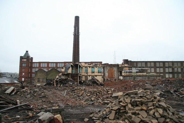
1910: A History of the County of Essex: Volume 6 (1973) states that the remaining brickworks – Wilson’s on Billet Road (where Waltham Park Way business park is today) and Barltrop’s at Chapel End (today’s Aveling Park Road and the north east part of Lloyd Park) – had also ceased trading by this time. Fletton clay from Cambridgeshire had superseded London clay as the primary choice for brickmaking, so production had moved out of London.
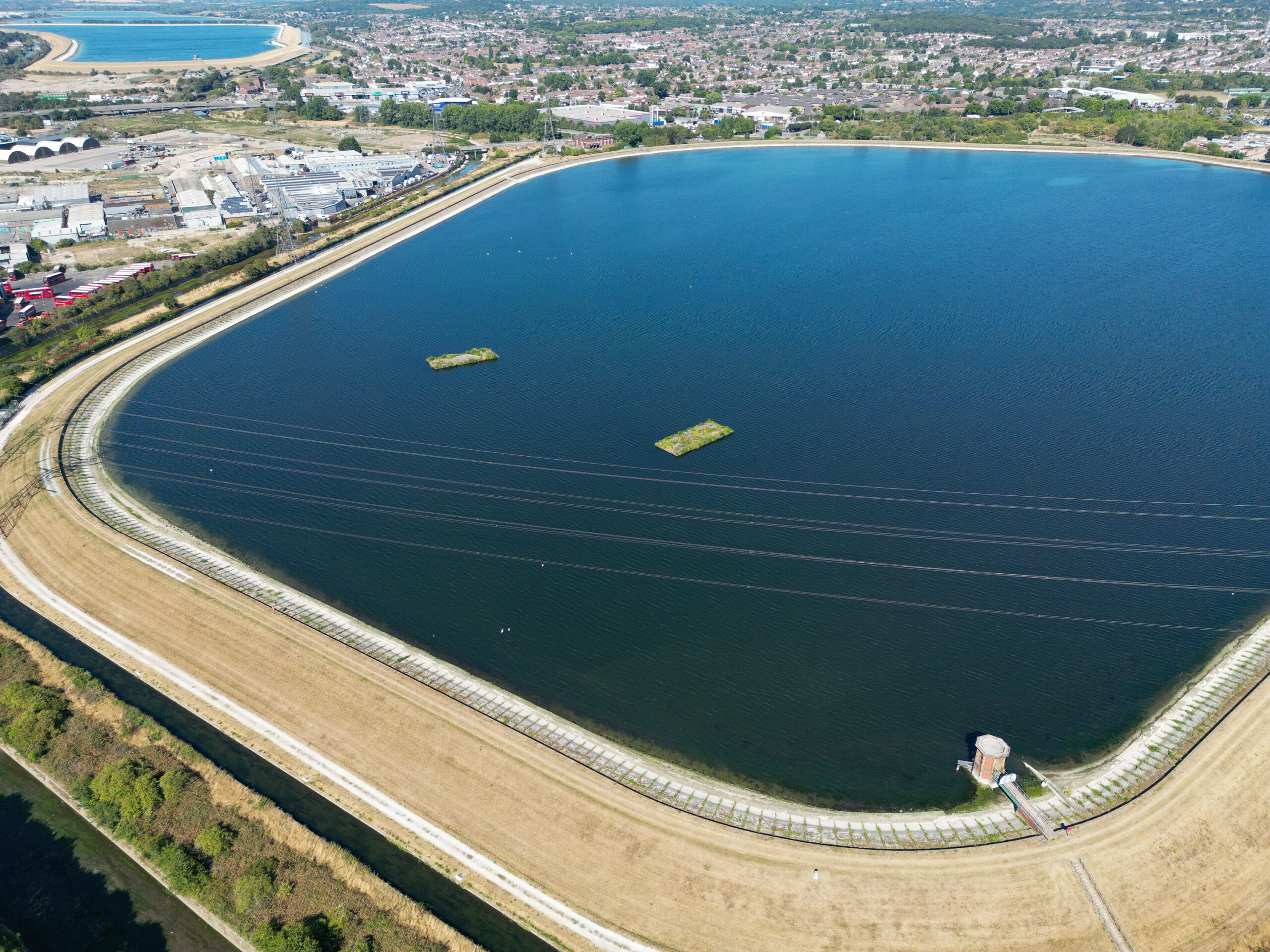
The Lea and Reservoir Chain
1594: A bridge existed over the Lea at Higham Hill – map OS Six Inch Essex LXV of 1863 places it at the present day footpath from Sandpiper Close into Wild Marsh East at the corner of Banbury Reservoir. By 1687 there was also a ferry called Boulton’s in 18th century and Games’s in 19th century. The ferry-house, which belonged to Salisbury Hall manor, stood on the west bank creating an extension of Waltham Forest into Middlesex.
1893: The Royal Commission on Water Supply (Balfour Committee) lead to the eventual creation of four additional reservoirs: Lockwood, Banbury, William Girling, and King George V, as well as the River Lee Diversion (its original course ran through the centre of what is now Banbury Reservoir so was re-channelled to the west of it). Works to create Banbury Reservoir and divert the River Lee were completed in 1903.
Land of Victorian Righteousness
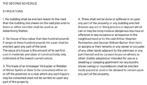
The present-day Title Deeds for houses on Cheney Row, Durban Road, Ascham End and Stow Crescent state that in 1899 Elizabeth Bacon & others indentured some land involving two other parties, Samuel Loveridge and Arthur Stephen Pemberton plus George William Barker. Full details were not lodged, but it seems likely that this was the land comprising the Stotter’s brickworks. In 1900 Pemberton & Barker conveyed a parcel of this land to William Blamyre Thornton & Richard Willock.
The accompanying covenant stipulates: “No caravan house on wheels or other chattel adapted or intended for use as a dwelling or sleeping apartment nor any booths shows swings or roundabouts shall be erected made placed or used or be allowed to remain upon any part of the property“. This may have been to limit what could done by Gypsy traveller communities, who have a very long association with the area and were granted an official site on Folly Lane under the Caravan Sites Act 1968.
There is also a covenant that prohibits: “the trade of an Innkeeper Victualfer or Retaifer of Wines Spirits or Beer“. This may reflect the popularity of the Temperance Movement in the area at that time. By 1880 there were five schools run by Protestant nonconformists in Walthamstow who were keen temperance advocates. Around this time the Victoria Hall on Hoe Street (where the Soho Theatre now stands) held temperance meetings, and The Lighthouse Methodist Church on Markhouse Road were also temperance advocates.
Cheney Row and Durban Road
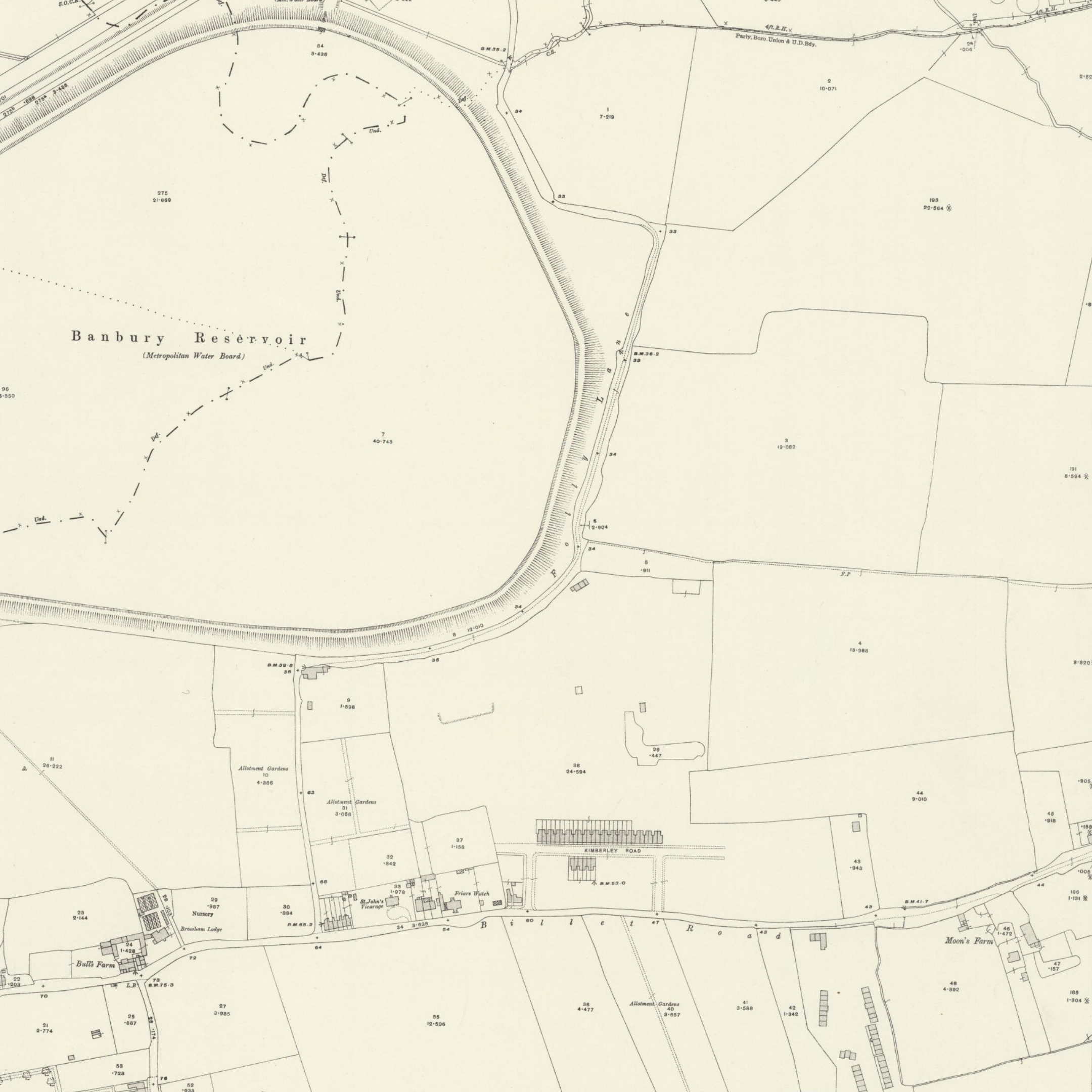
1913: Map OS 25 Inch Essex LXXVII.4 of 1913 shows that some of the buildings comprising Stotter’s brickworks had been demolished and dividing hedgerows with adjacent fields had been removed. Kimberly Road housing and the entrance of Durban Road are shown partially complete. A small building is shown adjacent to the lower part of what became Durban Road.
1935: Map OS 25 Inch Essex LXXVII.4 of 1935 shows that all of Stotter’s buildings had been demolished and the whole of the original Durban Road / Kimberley Road / Cheney Row / Ascham End estate had been completed, although we do not at present know exactly when. Stow Crescent and the lower part of Durban Road were built in the 1980’s.
A406 Walthamstow Avenue
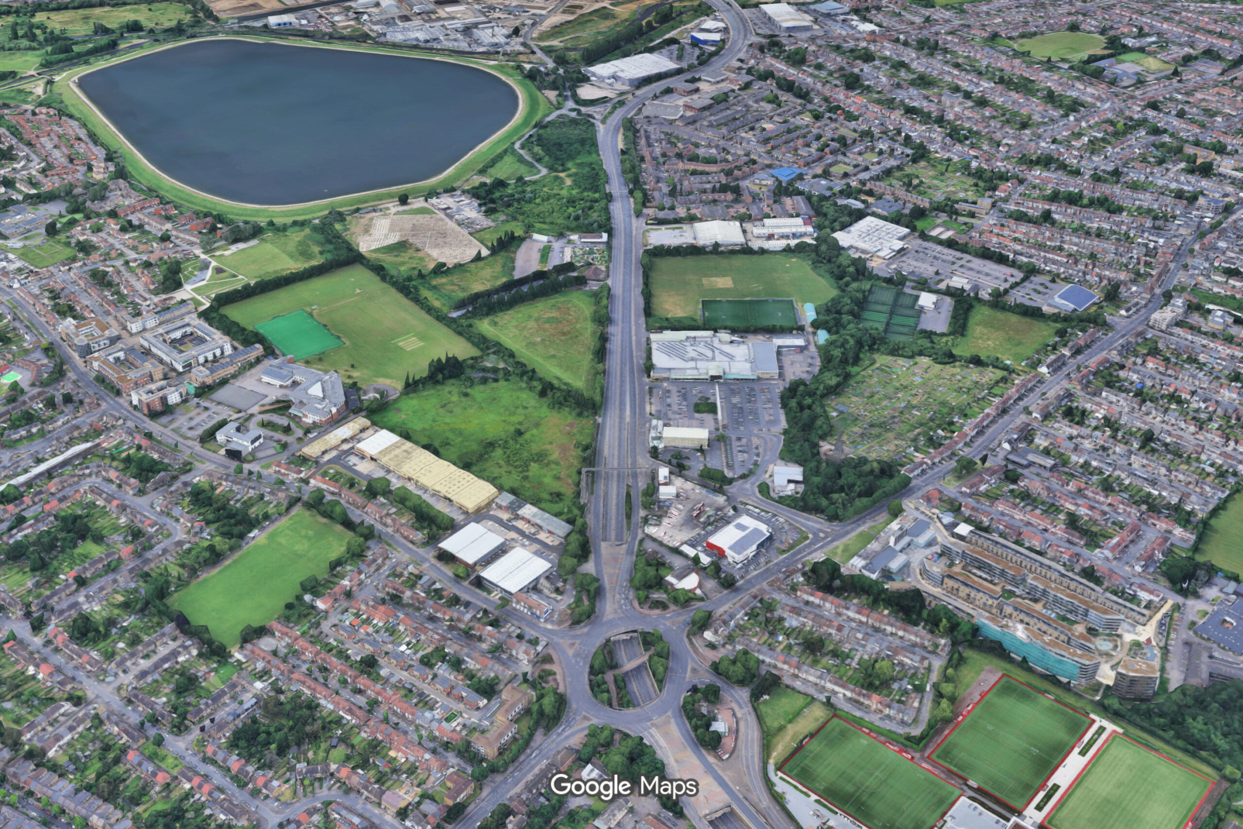
1925-1930: Walthamstow Avenue dual carriage way was built as part of the new A406 North Circular road, which originally started its route west at the Crooked Billet. Planning for the route of the North Circular began in 1919 and it was designated A406 in 1922. The ‘Folly Lane Triangle’ was thus created (with Billet Road forming the third side) of which Cheney Row Park is part.
The Lea Valley Viaduct provided the A406 safe crossing of the River Lea’s flood plain and was one of the first of its kind to be built using reinforced concrete. The A406 route east continued along Wadham Road and Beacontree Avenue. The eastern dual carriage way was build in stages – the segment connecting to the Crooked Billet was completed in the early 1990’s when the Crooked Billet pub was demolished to build the roundabout.
Sports Grounds and Allotments
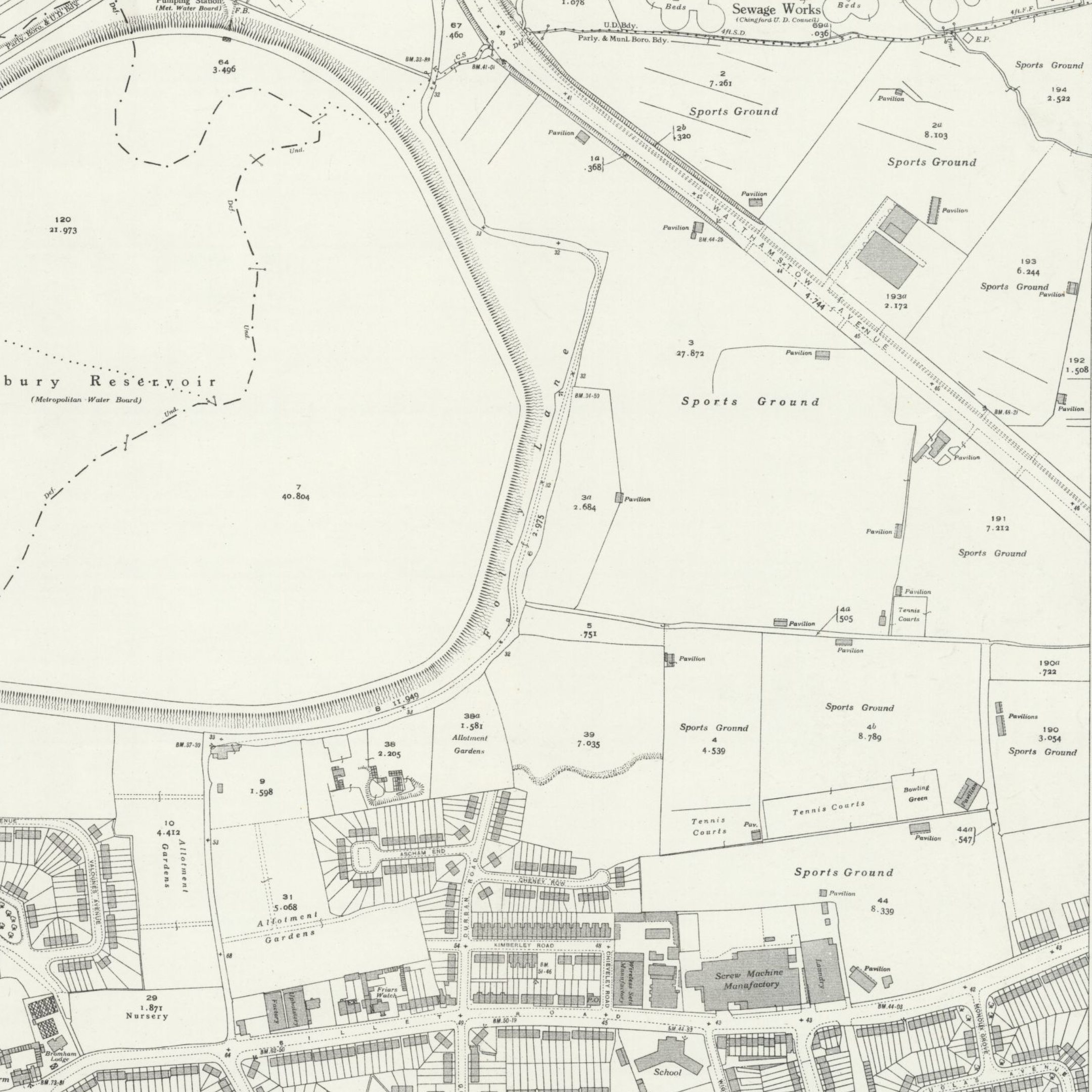
By the 1930’s, the Folly Lane triangle formed a large complex of allotments and sports grounds bisected by the A406, complete with multiple tennis courts and pavilions. Map OS 25 Inch Essex LXXVII.4 of 1935 shows this the clearest.
Map OS 1:1,250 TQ3691SE of 1955 describes Cheney Row Park as a ‘recreation ground’ as do maps OS 1:10,520 TQ39SE of 1968 , OS 1:10,000 of 1975-1977 and of 1990-1995 (these last two are no longer available for free).
Today, only two of those pavilions still exist: on Britannia Playing Fields behind Walthamstow Academy, and on Broadfields Sports Ground next to the A406 and Gökyüzü Restaurant.
World War II Anti-Aircraft Guns

1942-1955: In World War II, land next to Cheney Row Park was used for Heavy Anti-Aircraft Battery ZE10, one of 23 numbered HAA stations of London Inner Artillery Zone (East).
The reservoirs, Brimsdown power station and the industry around Higham Hill & Chingford made the area a prize target for the German Luftwaffe – ZE10 was the last line of defence.
Operational by at least 1942, it was armed with four 3.7-inch (94 mm) guns in concrete pits with GL Mark IA gunlaying radar. They fired 28 lb (12.7 kg) shells up to 32,000 feet (9.8 km) into the air. The site can be seen in aerial photos from 1947 (EAW005475 and EAW005469) as large circular structures and low buildings to the right of Banbury Reservoir.
After the war, the site became a Nucleus Scheme Headquarters Battery maintained by Anti-Aircraft Command, which kept selected HAA sites in working order during the early Cold War. ZE10 was a command & control location within that scheme rather than just an active gun site. Most of the Nucleus Scheme sites were stood down in 1955. Map OS 1:10,520 TQ39SE shows remnants still existed into the 1960’s.
The Landfill Mystery
1865-1972 ??: The field that became Cheney Row Park is listed by the Environment Agency as a historic landfill site for inert waste, active 1939-1972 (no further details available) and a 2007 AMEC Ground Investigation Report for LB Waltham Forest thought that the site was previously used as a landfill 1865-1952. The area known as Walthamstow Avenue Allotments (present day Folly Lane Community Woods) north of Cheney Row Park is also listed by the E.A as a historic landfill for inert, household, and commercial waste active 1955-1980.
No maps that we have seen between 1850 and 1990, nor any other online source, show or describe Cheney Row Park and surrounding fields as any kind of landfill – the reverse in fact! However a landfill did operate here at some time because the report commissioned by LB Waltham Forest in 2017 found conclusive evidence (building rubble and contaminants).
Given the wide range of dates, no evidence of readily degradable materials, and notoriously poor national record keeping on historic landfills, it is possible this is from the late Victorian period – demolition waste from Stotter’s brick factory used to fill old brickfield pits. Or from World War II bomb damage, of which there was a lot around Higham Hill, buried using emergency wartime / post-war powers.
A Valley of Electric Fields
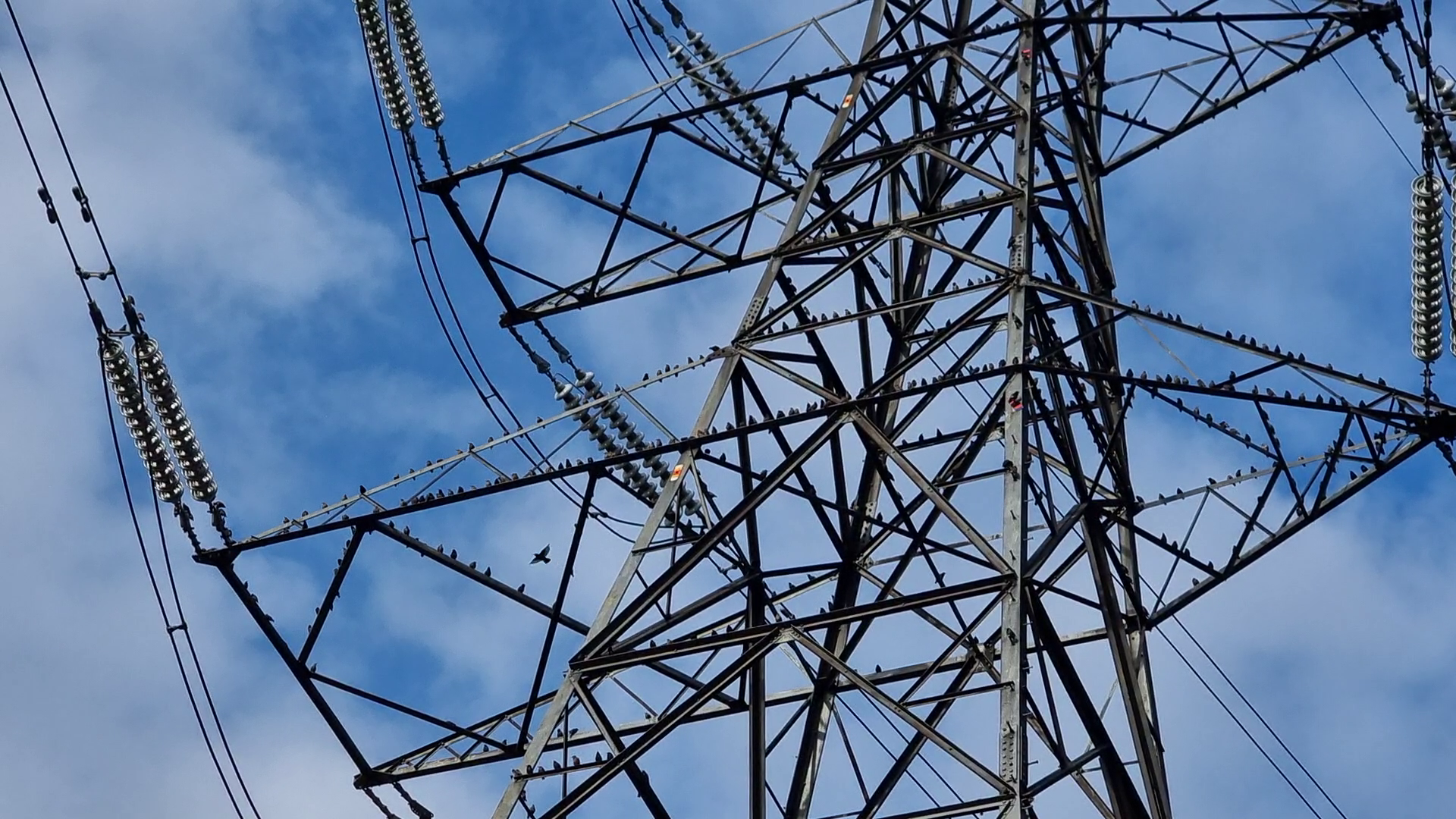
1953-1972: High-voltage overhead transmission lines and pylons were first installed in the Lower Lea Valley in 1953, with a major expansion in the early 1970’s. The line that run east-west immediately north of Cheney Row Park connects the Tottenham Marsh substation (just west of Banbury Reservoir) to Barking via Redbridge at 275KV (275,000 volts). Tottenham also links to generators at the Edmonton incinerator (visible from Cheney Row Park), Enfield Power Station (formerly Brimsdown), and further north via 400KV overhead lines.
Lee Valley Regional Park
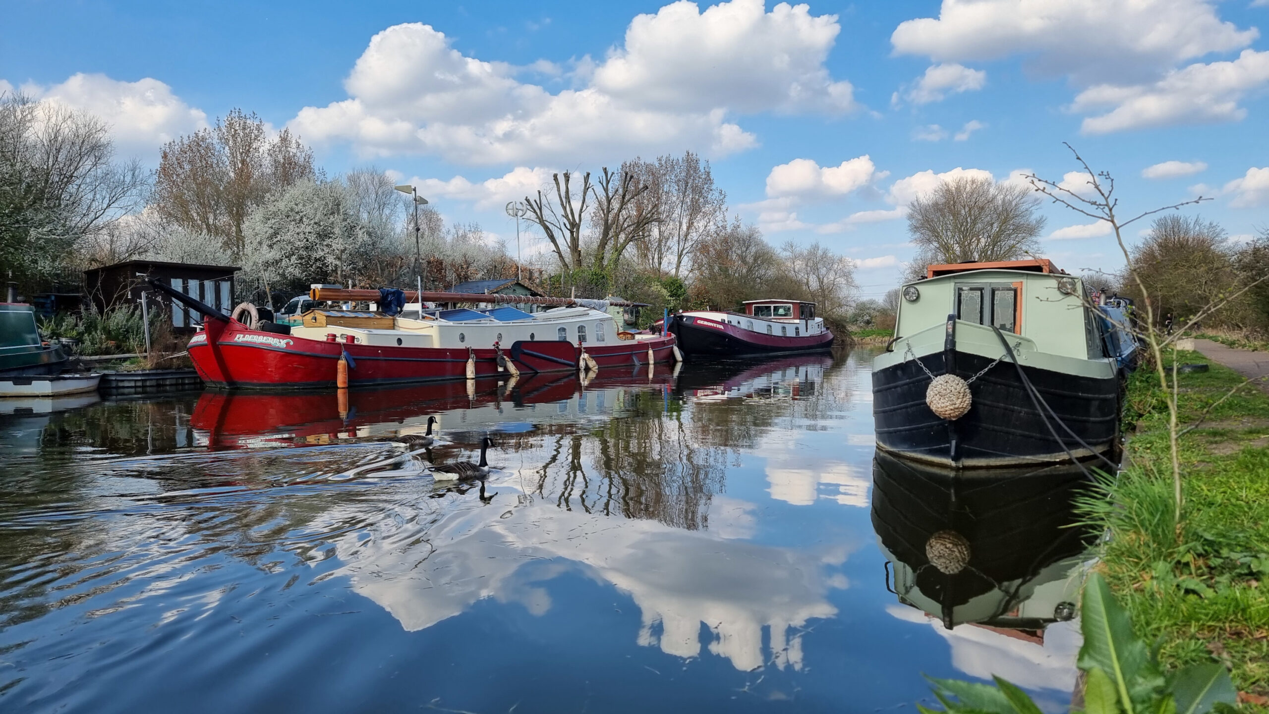
1966-1972: The Lee Valley Regional Park Bill received Royal Assent in December 1966, and the Lee Valley Regional Park Authority was formally constituted on 1 January 1967. Tottenham Marshes, including Banbury Reservoir and the Folly Lane Triangle, became part of the Lee Valley Park in 1972, which today encompass a 26 miles (42 km) long section of the River Lee covering an area of 10,000-acre (40 km2).
2010-2013: The Lee Valley Regional Park Authority adopted a Park Development Framework and created a set of proposals for improving the park. This included support for “works to improve the ecological interest of land within Folly Lane Triangle and access to nature opportunities, for example, by enhancing woodland and grassland habitat at Cheney Row and the Community Woodland.” and “the provision of local events space, play areas and fitness trail within Folly Lane at Cheney Row and measures to encourage community use and volunteer activities within the Folly Lane Community Woodland.“
Muslim Cemetery
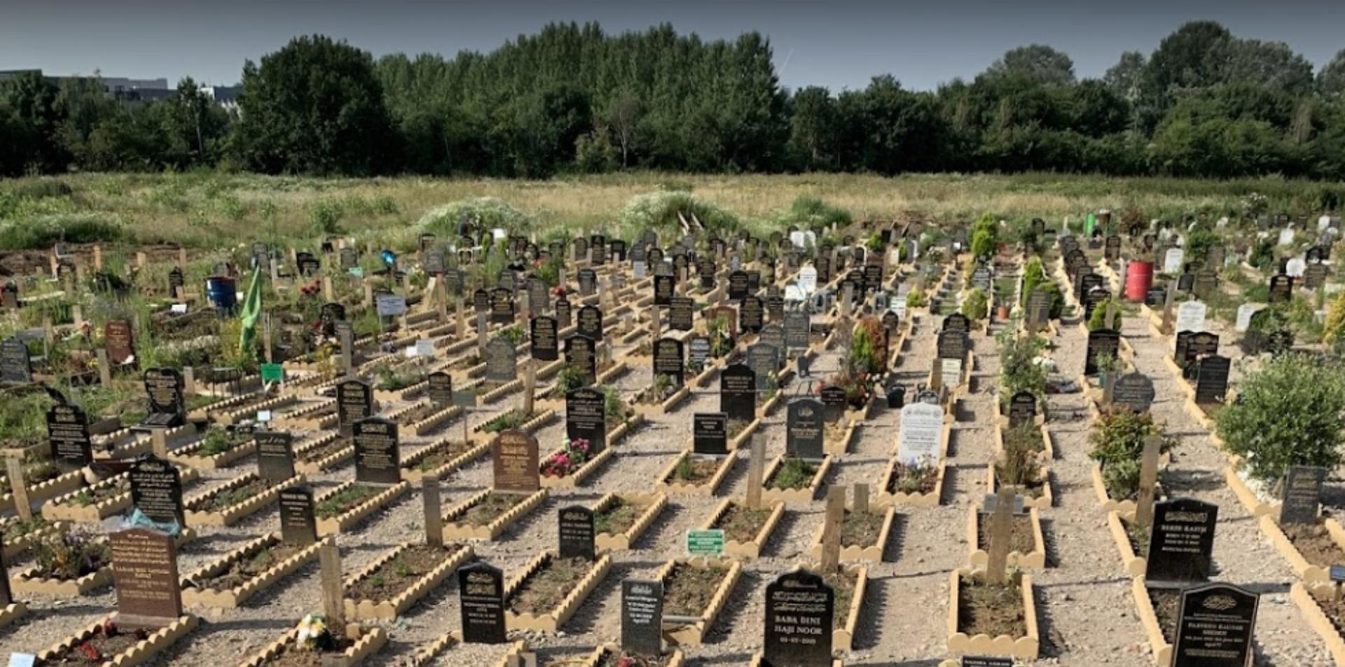
1992: The Waltham Forest Muslim Burial Trust was formed to serve the large local Muslim community by providing dignified, Sharia-compliant burial services at a site on Folly Lane adjacent to the footpath north of Cheney Row Park. It is the only dedicated Muslim-run burial ground in the borough, and one of only six sites in London.
Cheney Row Park
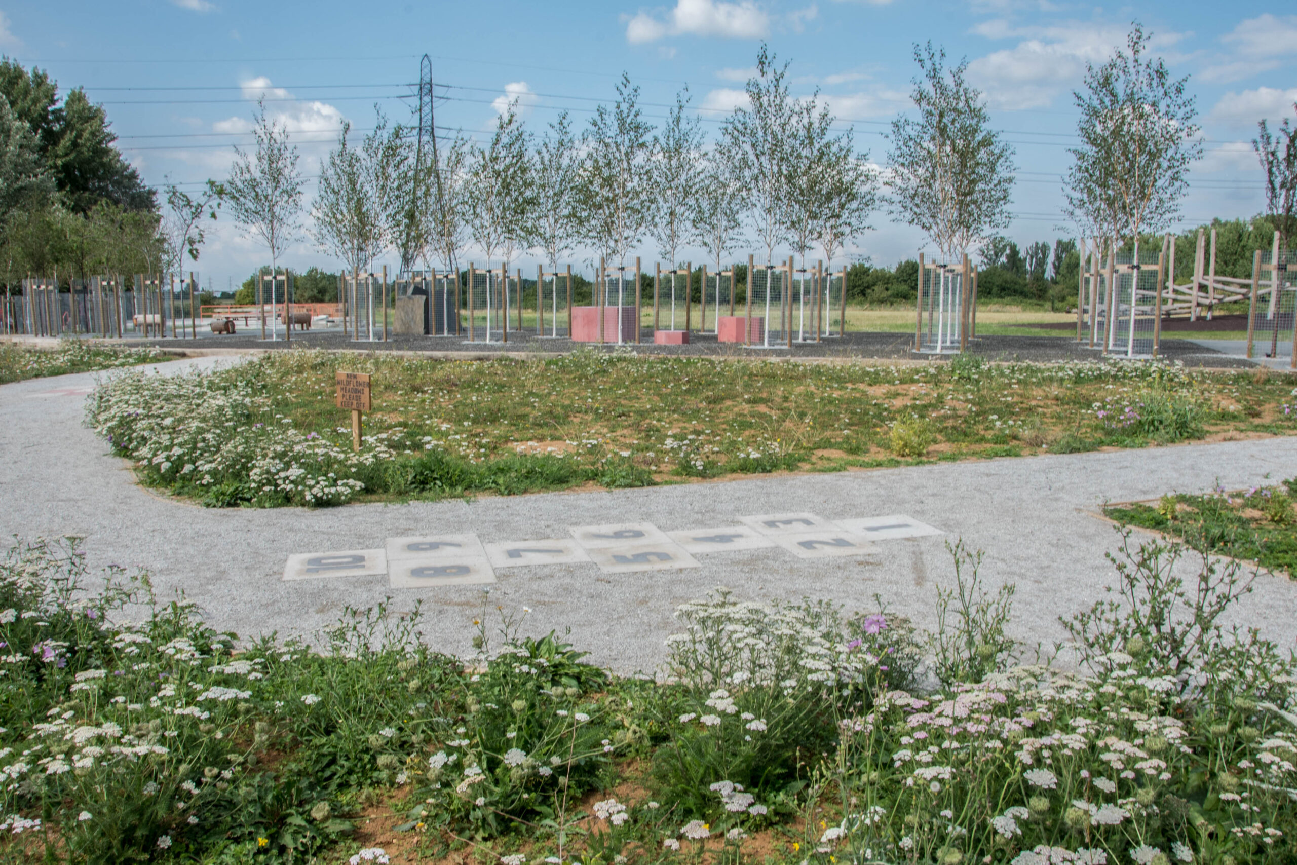
2006: London Borough of Waltham Forest applied to create an enclosed children’s play area for under 7’s and 7-12 year olds along the Durban Road side of Cheney Row Open Space (where the table tennis and concrete stage are today). This was approved but the work was not carried out. What was then known as Cheney Row Open Space was just scrubby grassland surround trees and undergrowth.
2011-12: The BMX track was initially built by local volunteers from East London Bicycle Organisation Cycling Club (ELBO CC), greatly expanding existing small earth mounds to create a rough track in March 2011. The Mayor of London at that time, Boris Johnson, attended one of the sessions and rode a BMX bike. Then in July 2012 Bike Track shaped it into a professionally surfaced track funded by grants from the London Mayors Facilities Fund, London Borough of Waltham Forest and Access Sport. Today the facility is managed by COG.
2017-2019: Planning and local consultations was carried out by London Borough of Waltham Forest to upgrade Cheney Row Open Space into what we now know as Cheney Row Park. Landscaping work by We Made That LLP began in late 2018, which included extensive remediation work to make safe contaminants from the historic landfill activities. The total cost was £1.2 million, paid from Banbury Park Estate Section 106 money. The new Park was officially opened at a community event on 18th May 2019 and the Friends of Cheney Row Park was created to bring together local volunteers to help manage the Park.
Banbury Park Estate
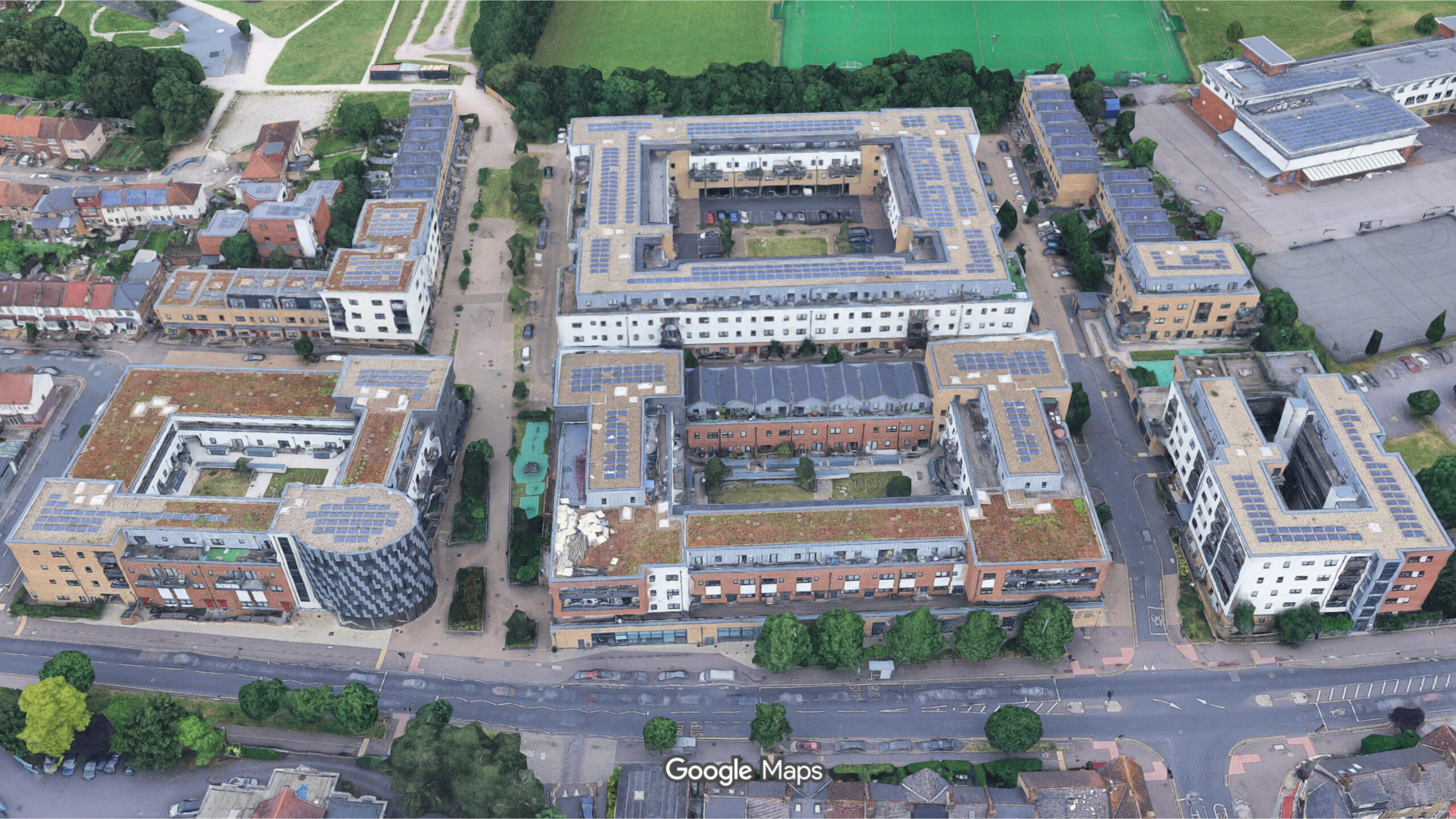
2014-2017: 350 homes were built at Banbury Park on the former Kimberly Works and Billet Works, 3.3 hectares of industrial warehouses and factories dating from the early 20th Century. The site is diagonally adjacent to Cheney Row Park and links via a path at the front of the BMX track.
Future Vision for Banbury
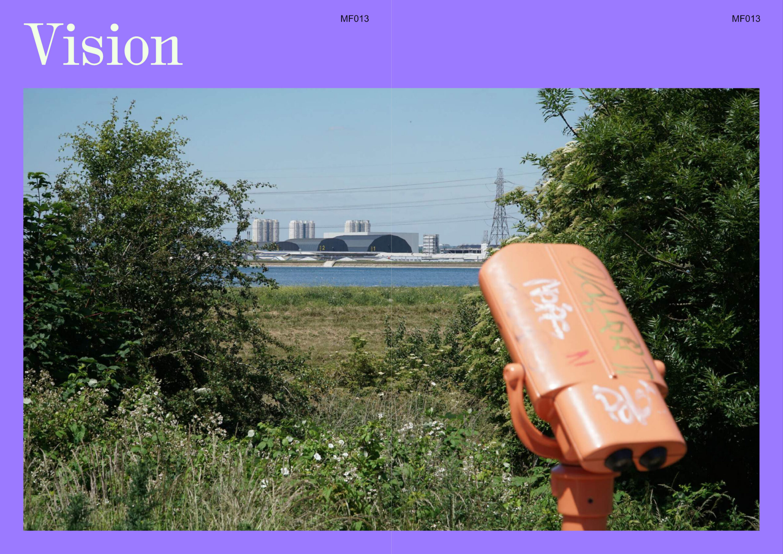
2023: The London Boroughs of Enfield and Waltham Forest published their combined Vision for Banbury Reservoir Area. In Enfield, the Meridian Water development seeks to deliver up to 10,000 new homes over the next 25 years, whilst in Waltham Forest, the North Circular Strategic Location is an important area for redevelopment.
The proposal reimagines the role of Banbury Reservoir and the surrounding areas as a place at the very heart of this new neighbourhood, connecting nature, trade and residential cores in a holistic and integrated approach towards urban growth. Cheney Row Park and Folly Lane are an integral part of this vision.